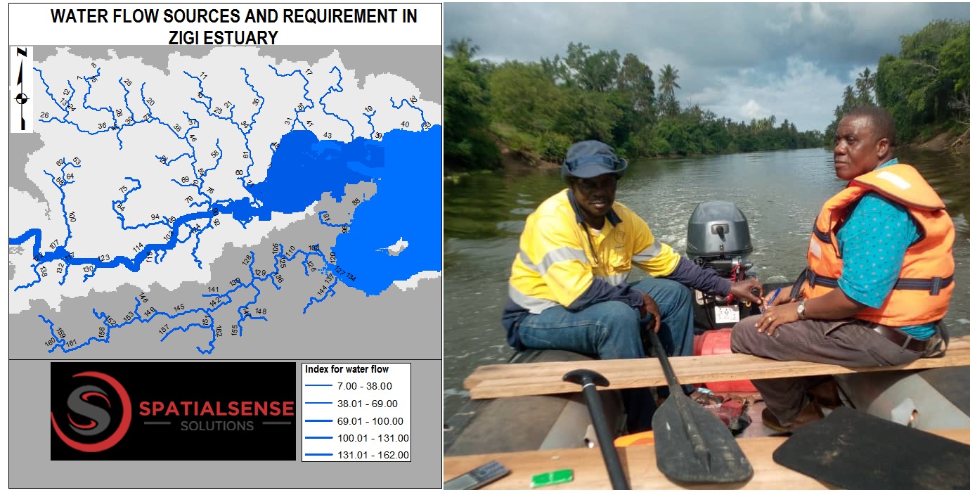
Environmental Water Requirement (EWR) Project
There is always competition for water use between humans and the environment. The use of water for human consumption from the Zigi River faces such competition. Spatial Sense Solutions is involved in estimating the amount and timing of water flow to the Zigi Estuary in Tanga Municipal to maintain the estuary’s health.
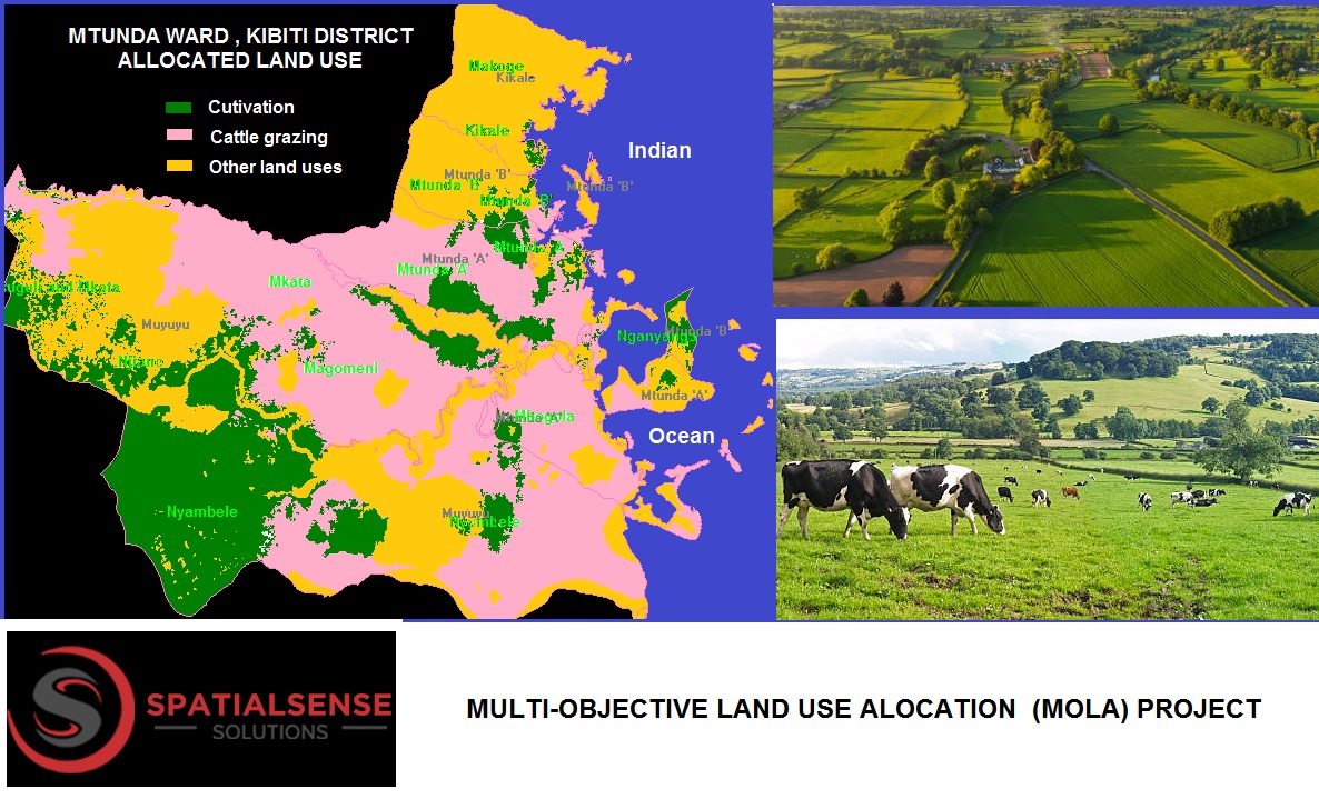
Multi-Objective Land Use Allocation (MOLA) Project
Land utilization often breeds conflicts among users when there is no proper means of allocation due to conflicting interests. Spatial Sense Solutions has developed a Geospatial-Based Model to apportion land among farmers and cattle keepers. This model also estimates the number of cattle that can be accommodated in Kibiti District, thus resolving conflicts between farmers and cattle keepers.


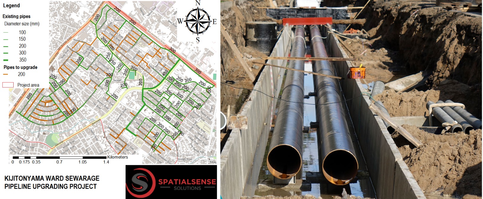
Central Sewerage System Upgrading (CSSU) Project
Central sewerage designs based on long-term population projections often lead to over- or under-capacity systems. Spatial Sense Solutions devised an upgrading plan for the Kijitonyama Sewerage System by identifying all existing buildings and their uses. We planned the current capacity of the system and future needs using geospatial-based analyses.


